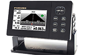
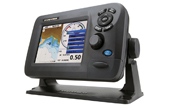
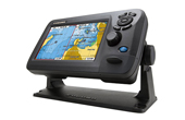
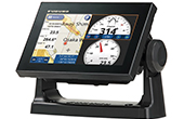
Máy định vị GPS hàng hải FURUNO GP-1870

Máy định vị GPS hàng hải FURUNO GP-1870
-Máy định vị - hải đồ nhỏ gọn với tính năng mạnh, phù hợp với các loại Du thuyền và Tàu đánh cá.
- Máy định vị - hải đồ màn hình LCD 7' mang đến cho người dùng tính năng mạnh, nhanh và các chức năng thông minh hơn vẫn với một kích thước nhỏ gọn.
- Màn hình LCD độ sáng 900cd/m2 giúp người sử dụng dễ nhìn ngay cả dưới ánh sáng mặt trời trực tiếp.
- Màn hình LCD tích hợp với kính chống phản xạ đảm bảo không bị hiện tượng mờ hơi nước.
- Nhìn được rõ ngay cả khi đeo kính râm loại có phân cực.
- Ăng ten định vị tích hợp bên trong máy giúp lắp đặt đơn giản và dễ dàng.
- Dùng với hải đồ C-MAP 4D tiêu chuẩn trên thẻ nhớ SD của Jeppesen.
- Chọn chức năng kiểu xoay RotoKey™ và thao tác kiểu Chỉ -và - Nhắp (Point - and - click) thân thiện.
- Tăng cường độ chính xác với bộ phận thu WAAS tích hợp sẵn.
-Định vị GPS: 50 kênh.
- Hải đồ điện tử 4D hàng hải.
- Dung lượng nhớ: 30.000 điểm nhớ, vết tàu: 1000 điểm lập trình, 5000 điểm đánh dấu tàu.
- Chức năng hành trình thông minh.
- Vẽ hành trình, dữ liệu hải hành.
- Nguồn điện: 12-24 VDC
- Dòng điện tiêu thụ: 0.88 - 0.46A
- Tiệu chuẩn chống nước: IP56.
- Phần mềm: Tiếng Việt/Anh.
- Bao gồm: Màn hình LCD, anten GPS, cáp nguồn, card hải đồ.
Đặc tính kỹ thuật
|
Loại màn hình |
LCD màu TFT |
|
Kích thước màn hình |
7' WIDE |
|
Độ phân giải màn hình |
800 x 480 pixels (WVGA) |
|
Độ sáng |
900 cd/㎡ (danh định) |
|
Dạng thu |
Định vị (GPS): 50 kênh. |
|
Tần số thu |
L1 (1575.42 MHz) |
|
Dung lượng nhớ |
30,000 điểm cho vết tàu và điểm nhớ |
|
Các chế độ hiển thị |
Vẽ hành trình, Dữ liệu hải hành, Trạng thái GPS |
|
Tiêu chuẩn chống nước |
IP56 |
|
Nguồn điện |
12-24 VDC |
|
Dòng điện tiêu thụ |
0.88 - 0.46 A |
7' WIDE COLOR LCD GPS/WAAS CHART PLOTTER FURUNO GP-1870
Compact, Powerful GPS Chart Plotter For Recreational And Fishery Boats
The 7' wide Chart Plotter provides the user with powerful, fast performance and intelligent features while remaining compact in size.
Features
Wirelessly connect to your iOS devices
The GP-1870/GP-1870F connects to your iOS devices using the app “Jeppesen Marine Plan2Nav” over a wireless ad-hoc connnection.
C-Weather information
C-Weather data can be downloaded from Jeppesen.com to the GP-1870/ 1870F. Wind, Wave, Weather, Humidity, Temperature and Visibility (fog) information can be displayed on screen.
Bright 900 cd/㎡ LCD gives excellent readability even in direct sunlight
The LCD and AR glass are bonded together to ensure no fogging issues
Clear visibility even when wearing polarized sunglasses
The GP-1870 series has an LCD screen that does not “black out” when wearing polarized sunglasses, providing clear visibility from virtualy any angle.
Internal GPS antenna for simple and easy installation
RotoKey™ revolving menu and familiar point-and-click operation
The RotoKey™ has a two-fold function. Rotate the knob for a finely stepped zoom control. Push the knob to get full access to GP-1870/1870F controls.
Supports detailed C-MAP 4D charts by Jeppesen (Locally supplied with an SD card)
Dual Range Chart Display
In 'Dual Range Chart Display' mode, the GP-1870 series displays dual charts, both long and short range, at the same time.
Internal memory: Waypoint/Track 30,000 points, Route 1,000 routes
Bright 900 cd/㎡ LCD gives excellent readability even in direct sunlight
The LCD and AR glass are bonded together to ensure no fogging issues
Our bonded LCDs offer a fog-free structural design. This ensures that the display will never be affected by water condensation, caused by an air gap between the LCD and the front cover plate.
Clear visibility even when wearing polarized sunglasses
Easy-Routing function: Automatically create a route
The Easy-Routing Technology analyzes the high-quality C-MAP 4D data, works out the shortest route and then checks and displays hazards in each leg of the journey. Enter start and end points along with specific boat parameters and automatically receive waypoints of the shortest route.
The technology highlights potential hazards and displays varying levels of alerts for each segment of the route and allows you to manually adjust the route.
Internal memory: Waypoint/Track 30,000 points, Route 1,000 routes
Specifications
|
Display Unit |
|
|
Screen Type |
7' Wide Color TFT LCD |
|
Screen Resolution |
WVGA 800 x 480 pixels |
|
GPS Antenna |
Internal (external option) |
|
Display Modes |
Course plot, Nav Data, |
|
Instruments, Engine monitor, |
|
|
Anemometer, Fuel level gauge, |
|
|
GPS status |
|
|
Language |
English (US & UK), French, Spanish, German, Italian, Portuguese, Danish, Swedish, Norwegian, Finnish, Greek, Japanese, Chinese, Russian, Thai, Vietnamese, Polish, Bahase Malaysia, Bahasa Indonesia |
|
GPS / SBAS (WAAS/EGNOS/MSAS) |
|
|
Receiving Type |
GPS: 50 channels, SBAS: 1 channel |
|
Receiving Frequency |
L1 (1575.42 MHz) |
|
Accuracy |
GPS: 10 m max, MSAS: 7.5 m max |
|
PLOTTER |
|
|
Chart |
C-MAP 4D |
|
Memory Capacity |
30,000 points for ship's track and wayponts |
|
1,000 planned routes (Max. 50 points per route) |
|
|
5,000 quickpoints |
|
|
OTHERS |
|
|
Waterproofing |
IP56 |
|
Power Supply |
12-24 VDC |
|
1.05-0.53 A (Equip 520-5PD) |
|
|
1,37-0.64 A (Equip 50/200-1T) |
|
|
Size |
168 (H) x 271 (W) x 124 (D) |
|
Weight |
1.5 kg |
- Sản phẩm chính hãng FURUNO (Thương hiệu Nhật Bản).
- Bảo hành: 12 tháng.

| Tel: | (028) 7300 1535 |
| Showroom: | 92K Nguyễn Thái Sơn - Phường 3 - Q.Gò Vấp - Tp.HCM |
| Website: | www.sieuthivienthong.com |
| Email: | info@sieuthivienthong.com |


 92K Nguyễn Thái Sơn - Phường 3 - Q.Gò Vấp - Tp.HCM
  info@sieuthivienthong.com
 (028) 7300 1535
